For a large part of this last millennium, barring the last 55 years, India had many rulers. Be it the Mughals, Portuguese, or British, there has been no shortage of folks who wanted to rule this part of the world - after all, India was once called the land of milk and honey.
The city of Mumbai has several historic monuments and heritage sites, each telling its own tale. The Mahim Durgah, the Portuguese Church, or for that matter the Gateway of India, are all legacies of the ruler of that era.

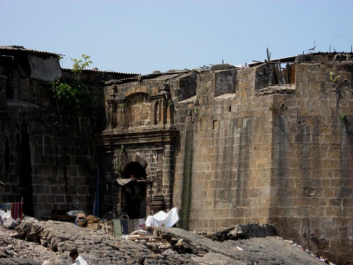
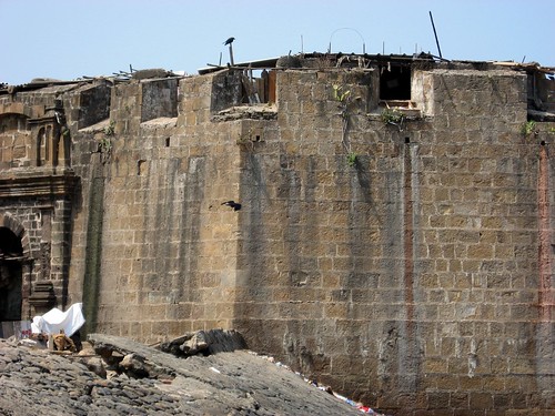
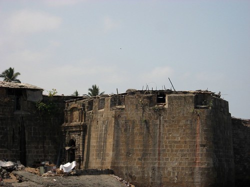
Of these, the Mahim Fort is a relic from the British Raj. This fort is actually a fortress - a part of the larger "Bombay Castle" or St. George's Castle. This castle was an important base during the time of the British Empire, but now all that remains are a few ramparts scattered about the city.
The Mahim Fort has cousins in Sion, Worli, Shivri and Mazgaon. The fort was built by the then Governor of Bombay, Gerald Aungier, in the year 1669, in order to strengthen British defences. He also made Bombay more populous by attracting Gujarati traders, Parsi shipbuilders, and Muslim and Hindu manufacturers from the mainland.
A man named Thomas Grantham then strengthened the fort's ramparts in 1684. In the year 1772, 111 years after Bombay was taken from them, the Portuguese attempted to attack this fort. The British replied with cannonballs and thunder. In fact, the Bandra church also bore the brunt of their fire. By all historical accounts, there were apparently 100 soldiers and 30 cannons in the Mahim Fort at that time.

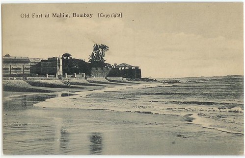
It is therefore anti-climactic that today, in all probability, all one can find are encroachers and hutments in the area. It is sad that a heritage site with such a glorious past, has been allowed to run to seed. The fort which was once visible from the Mahim Causeway and Bandra Reclamation, is barely visible now. The Mahim Fort needs to be restored and given the status of heritage structure.
A case of Mahim Fort, Mahim, Mumbai, submitted by Swetal Kanwelau of the Kamala Raheja Institute of Architecture & Environmental Studies, Mumbai, won the second prize at the Second IAHH International Student Design Competition. The results were announced in February 2004. The competition was aimed at investigating the issue of urban decay and degradation to evolve a more enlightened approach to planning, design and management of revitalisation, restructuring, redesign, conservation and redevelopment of such urban areas.
Fact File
Location: Mumbai
Distance from major cities:
Pune - 165 km
Villages at Foothills: Mahim
Altitude: Sea Level
Latitude: 19°2'31"N
Longitude: 72°50'17"E
Best time to visit: Throughout the year {mosmap lat='19.042056'|lon='72.838108'}
topHistory
In 1684, the fort was strengthened by Sir Thomas Grantham. In 1772, the Portuguese attempted to attack this fort, but
they were repelled by the British with cannon balls. The Mount Mary's Bascilica also was damaged during this encounter.
According to accounts, the fort had 100 soldiers and 30 cannons at that time.

topAttractions
The fort lies off the Mahim Causeway which links the suburbs to the city. The mushrooming of slums and encroachment
around the fort has lead to it being in a dilapidated state, with cracks appearing. Tidal changes in the Mahim Creek have
also contributed to structural changes. The Bandra-Worli Sea Link poses a threat to it.
OLD SNAP >>

<>


No comments:
Post a Comment